Lighted Spaces and Landscapes
Excerpts from a Geographer's Photo Archive
recent posts
- That is a Wall Map
- Where is Steve McQueen?
- Always Good Advice
- Commuting Crossing
- Say it Out Loud
- Total Wisconsin Joke
- Sometimes you Need a Warning
- Why Buy When You Can Rent?
- Funeral Humor
- The Center of Things
- Got My Goat
- Sometimes I’m Caught
- Love the Light
- The Sun is on the Flag
- Four Arenas–Four Sizes
- When the Conference Gets Dull. . .
- Waiting on the Ferry
- Corporate Mashup
- Not Beautiful, but Still Memorable, and Malleable
- It was a “Working Beach Day”
- Not All Doors Lead Somewhere
- Museum Door
- Ice Cream Has Priority
- Go Slower Next Time
- Mi Padre y Yo
Category: Chicago
-
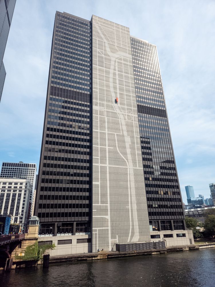
Coming out of Union Station you are struck by the city’s 2nd most important water feature after Lake Michigan. One of the first things you see is the map of the canals and rivers along the side of the 300 South Wacker Building (Chicago, Illinois, 2025)
