Skip to content

Lighted Spaces and Landscapes

Excerpts from a Geographer's Photo Archive

  • *What Lighted Spaces and Landscapes is About
  • *The Above63 Blog
  • *About Me

recent posts

  • Milwaukee Cruise Season Starts Today
  • Three Rivers
  • High Line View
  • Great Tag Line
  • Old Home New Jersey
  • Grand Central Stars
  • Next Time, Staten Island
  • Not So Secret Secret Park
  • Leon’s
  • Third Ward BOGO
  • City Hall for 414 Day
  • Night Sunburst
  • You’ve Got to Have Art
  • Hidden Gem in Bay View
  • It’s About the Workers
  • Camping in New York City
  • Patient Parent
  • When?
  • They Remember
  • Then Visit The Very Large Array
  • Only Twice A Year
  • It Screams Eat Breakfast Here
  • It’s Good to Get Out and About
  • Real Sign, Real Place, No Joke
  • Boulder Dam Lobby

That is a Wall Map

March 20, 2026

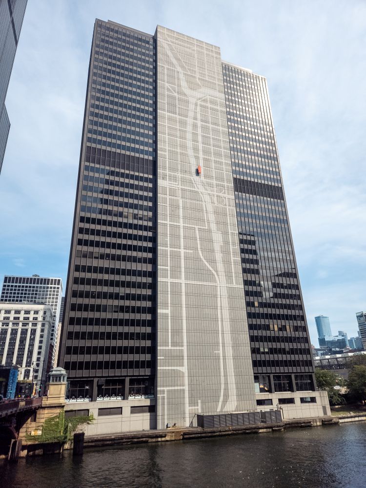
Coming out of Union Station you are struck by the city’s 2nd most important water feature after Lake Michigan. One of the first things you see is the map of the canals and rivers along the side of the 300 South Wacker Building (Chicago, Illinois, 2025)

Share this:

  • Share on X (Opens in new window) X
  • Share on Facebook (Opens in new window) Facebook
Like Loading…
Posted in Chicago, Urban, Water

Leave a comment Cancel reply

←Where is Steve McQueen?
Natural Green→

Blog at WordPress.com.

Loading Comments...

    • Comment
    • Reblog
    • Subscribe Subscribed
      • Lighted Spaces and Landscapes
      • Already have a WordPress.com account? Log in now.
      • Lighted Spaces and Landscapes
      • Subscribe Subscribed
      • Sign up
      • Log in
      • Copy shortlink
      • Report this content
      • View post in Reader
      • Manage subscriptions
      • Collapse this bar
    %d